|
|
TAMPA BEFORE 1850 - WHO WAS HERE AND WHEN DID THEY ARRIVE?
What kind of settlement was early Tampa in
the years of Fort Brooke? Was it a place ready for civilian
settlement and starting a homestead? How safe was it here during the
period of the 2nd Seminole Indian War and why would a family settle here,
especially if widowed with children?
|
|
The Hackley Spanish land grant
Even before the establishment of Fort Brooke
in 1824, privately owned land around the mouth of the Hillsborough River
had its beginnings in 1818 while Florida belonged to Spain.
| |
RICHARD S. HACKLEY
Richard
Shippey Hackley (born 27 Jul 1770 in Spotsylvania
County, Virginia) was a successful and well-traveled
merchant who resided at various times in Fredericksburg
, Norfolk, Richmond, New York, Florida and Spain. By
1789 he was an established merchant in New York. In 1806
he was a appointed U.S. Consul at St. Lucia, Spain, and
in 1807 he was appointed U.S. Consul at Cadiz, Spain,
the latter being a more prestigious position at that
time. Richard had claims to 12 million acres of
uncultivated land near present day Tampa, Florida. He
was deeded this Florida land by the Duke of Alagon on 29
May 1819, who previously had been granted this tract by
the King of Spain by order dated 17 Dec 1817. (This
claim has been well documented and was asserted by a
number of the heirs of Richard for a number of years
following his death.)
See World Connect Rootsweb for more details of the case
and Hackley genealogy |
Richard S. Hackley, the former consul of the
United States at Madrid, claimed that he had proposed a contract for half
of a Spanish land grant with the Duke of Alagon on January 1, 1818, and
the two had signed a contract for it on May 22, 1818. The Duke of
Alagon grant included the central part of Florida extending from latitude
29.5N at Micanopy to latitude 25.5 N (Key Biscayne) about half of
present-day Florida and most of the Florida peninsula. Since
Hackley’s wife (Harriet Randolph) was a sister of Governor Thomas M.
Randolph of Virginia and Hackley knew many important people including
former President James Madison--he had considerable political clout.
|
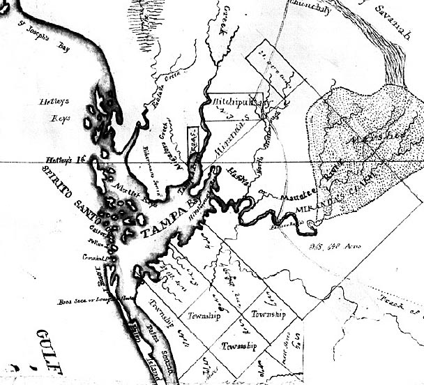
Below is a
manuscript map of the lands belonging to R. S. Hackley
Esq. covering all of Florida between Micanopy in the
north to Key Biscayne Bay in south, circa 1823. This map
shows roads, cities and towns, location of land
ownership and inland waters. The shaded areas are swamp
land. At lower left is probable reference to 1823 Map of
Florida by Charles Vignoles.
Digitization provided by the USF Libraries Digitization
Center, Rare Maps. |
|
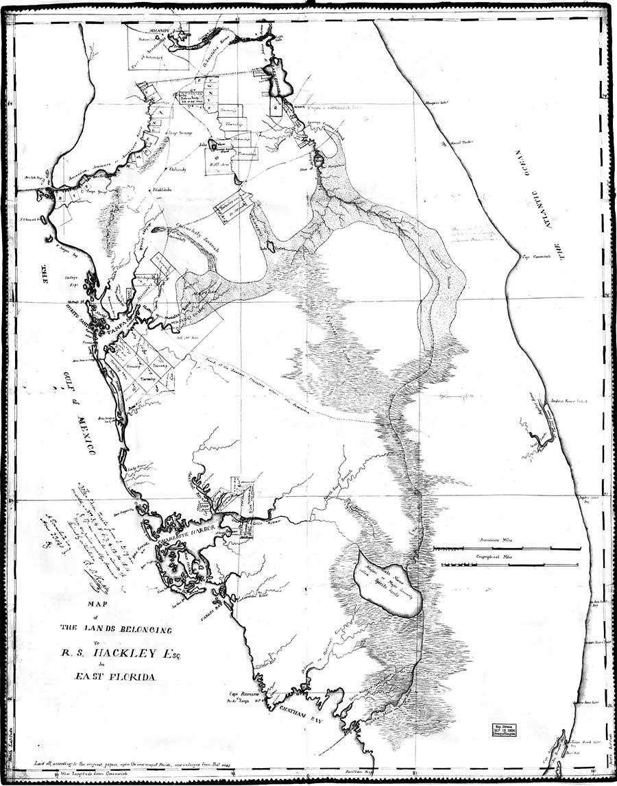
Map of the Lands Belonging
to R.S. Hackley, esq., in East Florida, 1823 AD
Historic map from Exploring Florida, Maps Etc.
Enlargements:
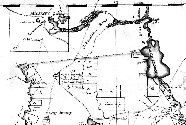
Northern border of Hackley land at Micanopy.
|
|
At right,
enlargement of "Bahia Espiritu Santo" - Tampa Bay.
Above,
southern limit of Hackley land at Key Biscayne.
|
 |
|
|
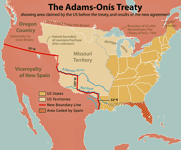
SPAIN CEDES FLORIDA TO THE U.S. BY TREATY
The
Adams–Onís Treaty of 1819 was a treaty between the United States and
Spain in 1819 which gave Florida to the U.S. and defined the boundary
between the U.S. and New Spain. The treaty is named after the men
who negotiated the agreement: John Quincy Adams, Secretary of State of the
United States, and
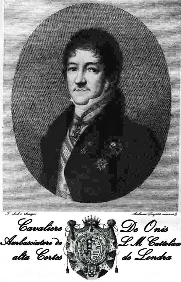
Don
Luis de Onís y Gonzalez-Vara (1762–1827), the Spanish minister in
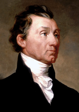
America. The treaty was negotiated during the presidency of James
Monroe, the 5th American President, who served in office from March 4,
1817 to March 4, 1825, and was one of the important events during his
presidency.
When John Quincy Adams was discussing the
treaty with Onís, they decided it should stipulate that the U.S.
Government would honor all Spanish royal land grants in Florida made
before January 28, 1818. In other words, the United States would
recognize the owners of those Spanish grants in Florida before that date
as being the rightful owners of American Florida land. Those grants made
after that date would be declared null and void and revert to ownership by
the Federal government.
|
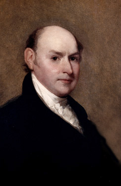
John Quincy Adams, 1818
Portrait by Gilbert Stuart
Info & image from Wikipedia |
However, Onís would have been willing to nullify all land
grants made by Spain going back to 1802 (instead of after Jan
28, 1818) but Adams let this point slip by and would soon
discover that since so many large grants had been given by
Spain in those years from 1802 to 1818 that much of Florida
would have still remained under Spanish control in private
hands if the treaty was drawn with the 1818 date.
It was Henry Clay, Speaker of
the House of Representatives, who discovered the oversight
made by Adams and insisted that corrections be made. Clay
discovered that if the treaty had been approved as it stood,
much of American Florida would remain in foreign ownership.
Accordingly, Adams informed the Minister to Spain, George W.
Erving, that the United States would not ratify the treaty
unless the King of Spain nullified the grants awarded after
1802.
When speculation reached
Spain that the grants from 1802 to the present time would be
nullified, parts of those grants were assigned to American
citizens with the hopes that they could influence members of
Congress and gain some profit from the aborted transaction.
Acting under American pressure the Spanish representative body
known as the Cortes annulled the post-1802 grants on October
5, 1820, and on October 24 of the same year King Ferdinand VII
approved the action of the Cortes. |
 |
|
Adams served as
Secretary of State throughout James Monroe's eight-year
presidency, from 1817 to 1825. Taking office in the aftermath
of the War of 1812, Adams thought that the country had been
fortunate in avoiding territorial losses, and he prioritized
avoiding another war with a European power, particularly
Britain. |
Cavaliere De Onis,
Ambassador of the Catholic high Courts of London.
His last diplomatic mission sent him to London in February
1821, where he participated in diplomatic consultations for
the recognition of Hispanic American countries by the United
States and managed to prevent the European powers from
following the US example. In November 1822, Onís returned to
Madrid, where he died on 17 May 1827, after an illness of four
days.
Image and info from Wikipedia |
ENTER RICHARD & SON ROBERT HACKLEY
In July, 1822 Richard Hackley sent S. S.
Seymour to look over his prospective land holdings in Florida which he had
been granted from Spain in 1818. Although Seymour saw no Indians in
the bay area, there probably was an active village at Thonotosassa and an
abandoned one at present day Plant City. There were no Cuban fishing
ranchos in the Tampa Bay area and Seymour had learned one had been there
probably on Mullet or Egmont Keys but the fishermen left when the United
States acquired Florida from Spain.
It was also at this time that Richard
Hackley began sell large parcels of "his" land, even though the treaty had
annulled all of Hackley's land claim in Florida.
Seymour wrote such an excellent report
concerning the commercial possibilities of the thick forests and bounties
of seafood that Hackley sent his 25 year old son, Robert Jackson Hackley,
to Florida in November 1823 to establish the family plantation at Tampa.
Robert made a landing at the juncture of the Hillsborough River and
Hillsborough Bay and began laying the foundations of what he hoped would
be a profitable family plantation.
According to Robert Hackley, there were only
Indians, alligators, panthers and wolves on the land and no white
settlers. Since he had brought with him spades, hoes, a plow, and a work
force of 16 white men. Hackley proceeded to clear the land of trees
and underbrush. Soon, rows of orange, grapefruit and lemon trees
were planted , and land was cleared for a house. He assembled a frame
dwelling that he had carried by boat from New York City.
So far as can be determined, the Hackley
house was built on lots 9-10, Section 24, Township 29 South, Range 18
East. Soon the cattle, oxen, hogs and poultry which had been carried from
New York were earning their keep by clearing the Florida vegetation. But
the Hackley plantation was destined not to last very long.
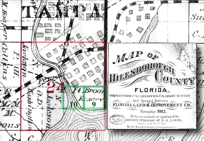
This
1882 land ownership map from the Library of Congress shows where the
Hackley property
was located outlined in green at lots 9 & 10 in Sec. 24 of Township 29
South, Range 18 East.
At the close of 1823, Robert Hackley set sail for a vacation in Pensacola,
scarcely imagining what would greet him upon his return: the official
arrival of the United States government. |
THE FORT BROOKE YEARS
Various historians who wrote about the early years of Tampa during
the Ft. Brooke years say that most all of the structures in the area were
concentrated on the Ft. Brooke property which was south of the present
Whiting St. There were very few private citizens who bought land and built
a home or business in the area of what would become the village of Tampa
in those times. If they did, they probably would have done so as
tenants of the fort with permission to live on the federal property due to
their involvement with the military. Land sales were not authorized
by the Federal government at this time because the area that became the
village of Tampa wasn't given to the county by the federal government
until 1845 when the size of Ft. Brooke land was reduced. Florida
wasn't even a state until 1845. Those private citizens who bought land
originally part of the Hackley Spanish land grant before 1838 eventually
lost their claim to the land by around 1840. |
|
 |
|
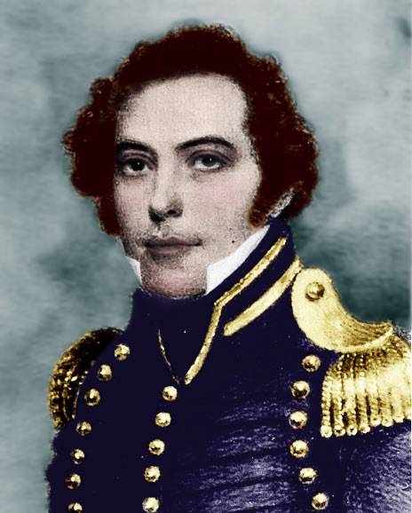
James Gadsden (1788 -
1858) was a protégé of Andrew Jackson. In 1824, six
years after this portrait was done, he surveyed the bounds of
Florida's Indian nation, exploring, in the process, much of
the Peace River valley. Photo colorized from Canter
Brown Jr's Florida’s Peace River Frontier, 1991.
|
ESTABLISHMENT OF FORT BROOKE IN 1824
Fort Brooke was established in response to
the Treaty of Moultrie Creek, an agreement negotiated between the new
American government in Florida and the Seminole tribes in 1823, calling
for the removal of the Indians to the southern part of the state. Millions
of acres in central Florida from Ocala to Charlotte Harbor were set aside
for an Indian reservation.
The Federal government decided to establish
a string of forts in various parts of South Florida to police the area and
keep the Indians down. (All of the Florida peninsula was considered to be
"South Florida.") A military post was suggested for
 the
Tampa Bay area to "protect" the Seminoles from outside influences, to
forestall the introduction of weapons from Cuba, and to serve as a station
for the Indians to obtain rations and supplies. Late that year Col. George
Mercer Brooke, comfortably situated at Fort Clinch near Pensacola, was
ordered to Tampa Bay. the
Tampa Bay area to "protect" the Seminoles from outside influences, to
forestall the introduction of weapons from Cuba, and to serve as a station
for the Indians to obtain rations and supplies. Late that year Col. George
Mercer Brooke, comfortably situated at Fort Clinch near Pensacola, was
ordered to Tampa Bay.
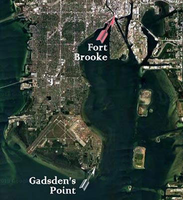
Col. James Gadsden first arrived on Jan. 8, 1824 to mark the boundaries of
the new military reservation. Thus, the landing place of the party was
designated "Gadsden Point," the area now occupied by MacDill AFB, and the
new fort itself was named to honor Brooke. Gadsden chose a tract on the
east bank of the Hillsborough River at the point where it enters
Hillsborough Bay, mainly because of the improvements already made there by
Robert J. Hackley.
|
 |
HACKLEY'S PROPERTY SEIZED
It took many months to secure the needed building supplies, equipment
and provisions, and the colonel was in no hurry to face the challenge of
the mosquito-ridden wilderness. Brooke and his five-ship convoy of the
Fourth Artillery arrived with four companies of militia on January 24,
1824, and began building the cantonment on the northeastern bank of the
Hillsborough River while Hackley was on his trip to Pensacola.
"We found a jungle-like land with giant
live oaks spreading enormous limbs as big as tree trunks, hung with
pendants of Spanish moss and yellow Jessamine," he wrote in his
journal (without any mention of Hackley's plantation.) Brooke spent the
first month landing supplies, clearing the “worst undergrowth he had
ever seen," and planting gardens.
|
|
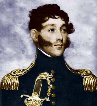
George Mercer Brooke
(1785-1851), United States Army, colorized from a portrait
presented to Gen. Sumter L. Lowry, by Col. George M. Brooke,
Jr. at a dinner of the Tampa Historical Society.
|
By March the troops had realized what a
comfortable house Hackley had built and taking advantage of Hackley's
absence they seized the house from an agent of Hackley named Rhodes and
put it to use as officers’ quarters. It was difficult for Hackley to
oppose the claim of the troops for they occupied much of the land he
claimed and had built barracks, parade grounds and store houses there.
|
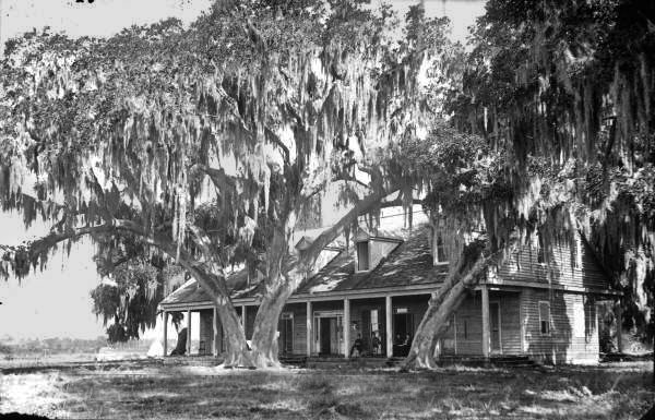
The Old Ft. Brooke Officers' Quarters in
1882 - 1887, originally Robert Hackley's home.
(State
Archives of Florida)
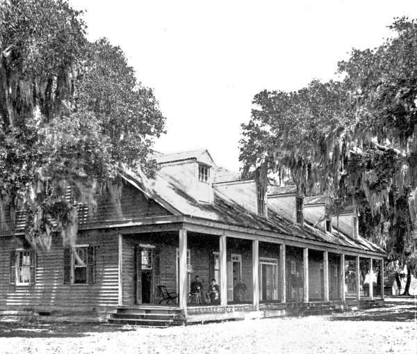
The Old Ft. Brooke Officers' Quarters in
1882 - 1887, originally Robert Hackley's home.
(State
Archives of Florida)
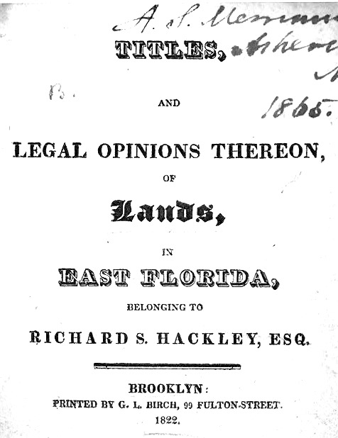 
See the 1822 publication
The seizure of the land by the troops was not a terrible setback for
Hackley. After the events of February, 1824, Hackley consulted with
several attorneys who as late as 1837 declared that his claim to the land
was valid. Taking advantage of these opinions Hackley sold some of his
land sited at the mouth of the Caloosahatchee River.
By 1829 some settlers had erected buildings
on the land but had not cultivated any crops or known their rights in the
matter. One such settler William G. Saunders who opened a general store at
the foot of present day Whiting Street in 1828. Other business ventures
established on the government land included a harness repair and shoe
shop, laundry, blacksmith shop, and ship repair yard. Such practices of
laying out towns on Federal land was commonplace along the frontier.
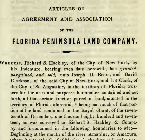
By 1837 the remainder of the so-called
Hackley Grant was vested in a company known as the Florida Peninsula Land
Company and capitalized for $200,000. Shares in the company or land
contained within the grant could be purchased from Augustus Steele, Lot
Clark, and four others including Robert Hackley of New York.
Florida Peninsula Land Co. Articles of Agreement from Internet
Archive
UNAUTHORIZED SALE OF PROPERTY AT FORT
BROOKE
Within a short time two important sales were made by the Florida
Peninsula Land Company which resulted in the development of two illegal
subdivisions. In 1829 Judge Augustus Steele from Connecticut purchased 25
acres at Fort Brooke from Hackley which was lying to the north of the
garrison just beyond the garrison buildings and parade grounds but still
part of Federal land. Steele was the county judge, postmaster
and deputy collector of customs, all at the same time.
It was through the strenuous efforts of
Judge Augustus Steele that Hillsborough County came into being in January
1834. The county, when created by the Florida territorial legislature,
stretched across much of west central Florida, from just south of what is
now Ocala all the way down to the northern tip of Lake Okeechobee, and
along the gulf coast from roughly north of Bayport south to Charlotte
Harbor. The new county, Florida's 19th, included few white civilian
residents. Still, Steele was able to not only secure the county but also
assign Tampa as the county seat. |
|
 |
Since Judge Steele was also the customs officer, he had been
permitted by the military to erect a house in 1830 near the
picket line on the Hillsborough River. Steele, a
wheeler-dealer, proceeded to lay out in 1838 the Town of Tampa
with Water Street 40 feet wide and Tampa Street 60 feet wide
and sell lots. When John Jackson drew the official
survey in 1847 he followed the plat made by Steele in marking
these two streets.
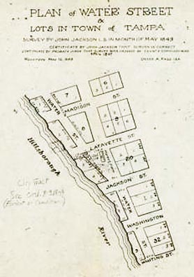
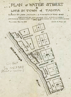
At right, 1849 sectional plan of Water Street by John Jackson.
|
 |
|
Both images are
from "Judge Steele Left His Mark" TBO.com |
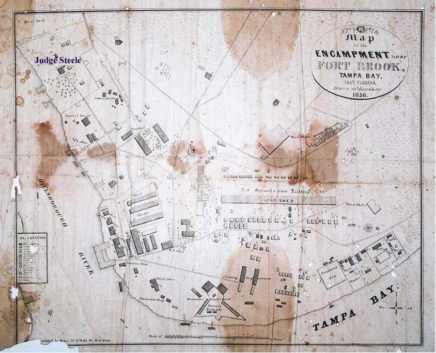
This 1838 map
shows Fort Brooke at its pinnacle, when it was the headquarters for the
U.S. Army of the South.
Matheson History Museum
Map from this Tribune 2016 article by Rodney Kite-Powell |
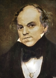
AUGUSTUS STEELE
Born in Connecticut in 1792 Steele came to Florida around 1825
originally settling in the St. Marks River area south of
Tallahassee. By the early 1830s he had settled in the Ft.
Brooke area. Beginning at this time Steele's accomplishments
are remarkable. He became notary public, fisheries officer,
and was the first county judge in Hillsborough County, a
county he practically founded himself through the sheer
force of his own energies. Steele was also elected to the
Territorial legislature two different terms. He was the first
to lay out the plats of what would become the city of Tampa.
After the Dade Massacre in December 1835, it was Steele who
delivered the message to the Governor in Tallahassee. Steele
relocated one more time and developed a resort in Atsena Otie
at what is now called Cedar Key in Levy County Florida. Steele
died in 1864 in Wellborn, Florida. |
 |
|
Augustus Steele at Find-A-Grave |
Composite image made
from
Tampa Bay History Center portrait at TBO and
portrait from Trip Advisor courtesy of Cedar Key
Historical Museum. |
|
FEDERALLY UNAUTHORIZED SALE
OF TAMPA LOTS (Cont. from above.)
The first lots in the 1838 town were sold to Captain Rufus
D. Kilgore who built the 12-room Tampa Hotel sited on the
Hillsborough River just north of the garrison. Records
indicate that lots 54 and 55 were sold by Steele to Sarah
Kilgore for $150.00 apiece in 1838.
In October, 1838, William Saunders purchased from Hackley for
$1,300, fifty-eight acres of land lying between Hillsborough
Bay and the West bank of the Hillsborough River. Saunders was
Ft. Brooke's sutler and Tampa's first postmaster. Several
months later, this tract of land was sold to Major Donald
Fraser, John Monroe and Henry Lindsey. The
purchasers contacted Steele who sub-divided part of the land
naming it Tampa City. In March, 1839, lots 39 and 40 fronting
on the west bank of the Hillsborough River and near its mouth
was sold for $60 to
Bartholomew Tole, a sergeant from Fort Brooke. Other
purchases included lots 35, 36, and 37 by Captain W. W.
Morris for $110.00 and lot 41 by Private Thomas Hagin
for $60.00.
THE TRUTH REVEALED
Within a short time Hackley shifted the focus of his attack.
Hope had risen in a different direction when Congress in 1826
passed a law which authorized a frontiersman to settle on
public land in Alabama, Mississippi and the Territory of
Florida, make improvements and be able to purchase the land at
a minimum price. Robert Hackley began to collect proof of his
possession in order to claim the land in court.
Judge Augustus Steele
certified on August 27, 1834 that he had known Hackley to
build a house and cultivate the land. Colonel George M. Brooke
testified on November 27, 1834 that he had seized the land
from Hackley, and one Lorenzo testified that he had seen the
16 hired men clearing the land. Accordingly on November
27, 1843, Hackley filed his claim for the land citing the
pre-emption law passed in 1826. Little is known of the action
taken on the claim but it probably was disallowed at the time.
Although both Gadsden and
Brooke admitted that they had taken over the clearing and a
house built by Robert Jackson Hackley in affidavits sworn in
1834, the courts ultimately ruled against Hackley's heirs.
(1884, 1908) |
|
HACKLEY LAND GRANT NULLIFIED, ORDER TO
REMOVE "SOONERS" IGNORED BY STEELE
In 1838 a federal court ruled Hackley's
grant purchase invalid, referring to the Onís treaty nullification clause.
The Federal Government became concerned with the illegal subdivision and
intruders upon the Fort Brooke military reservation but action was
virtually impossible. Federal law stipulated that the United States
Marshal had the power to remove the intruders and Marshal Joseph Sanchez
at St. Augustine had been directed twice to take action. His deputy,
however, refused to remove the illegal settlers when requested by the
commanding officer unless the County Judge instructed him. Of
course, Judge Augustus Steele would not give such orders to remove people
from land he had sold to them.
See Richard Hackley's petition and protest to President John Tyler in
1842.
REMOVAL OF JUDGE STEELE
There were so many complaints against
Steele’s conduct as postmaster and revenue collector that the Secretary of
War recommended his removal in 1839. After leaving Tampa in disgust
for Cedar Key when Hackley lost his bid to the Alagon grant land, he and
several persons including Hackley tried to claim the Fort Brooke land
under terms of the Armed Occupation Act but were denied such claims
because the act stated that claims had to be two miles or more from a
fort. Richard Hackley died soon after the ruling. Robert
Hackley died in Tallahassee in 1845, but the Hackley heirs continued their
litigation.
In a case brought before the U.S. Supreme
Court by Lot Clark, David Clarkson, Joseph D. Beers, Andrew Talcott,
Brantz Mayer and Harriet Hackley against Joseph Addison Braden, in
December 1853, this claim was finally settled. (1908 was the FINAL
decision.) It was determined that prior to ratification of the treaty
transferring Florida from Spain to the US, the King of Spain annulled the
grant to Alagon in response to concerns of the US negotiators . Based
primarily on this fact, the court upheld the findings of a lower court,
determining that the Hackleys derived no title from the U.S. government in
said land.
See "The
Final Battle for Fort Brooke" here at TampaPix.
|
|
Col. George Mercer Brooke - He Built A Fort In The Wilderness,
by June Hurley Young
Early Days At Fort Brooke, By Col. George Mercer Brooke, Jr.,
Professor of History Virginia Military Institute, Lexington, Va.
The Hackley Grant, The Fort Brooke Military Reservation and Tampa,
by James W. Covington, PH.D.
Outlaws, Inlaws and Everyone in Between, a genealogy of Richard
Shippey Hackley including son Robert Jackson Hackley, World Connect
Rootsweb. [This source erroneously cites
Hackley's petition in Nov. 1842 as being to the President of the
U.S. Zachary Taylor. The petition was to John Tyler who
was president at that time.]
Some Observations Concerning The History of Fort Brooke and Tampa,
by James W. Covington |
|
TAMPA'S REVIVAL
The turnaround for Tampans began
in 1845, when Florida achieved statehood. The legislature soon reaffirmed
and legitimized Tampa's role as Hillsborough County's seat. The new
state government also threw its weight behind attempts to compel federal
authorities to grant title to the land upon which the town stood. An
elected county government organized under state law in January 1846, just
as most regular Fort Brooke troops departed for service in Texas
preparatory to the Mexican War. |
|
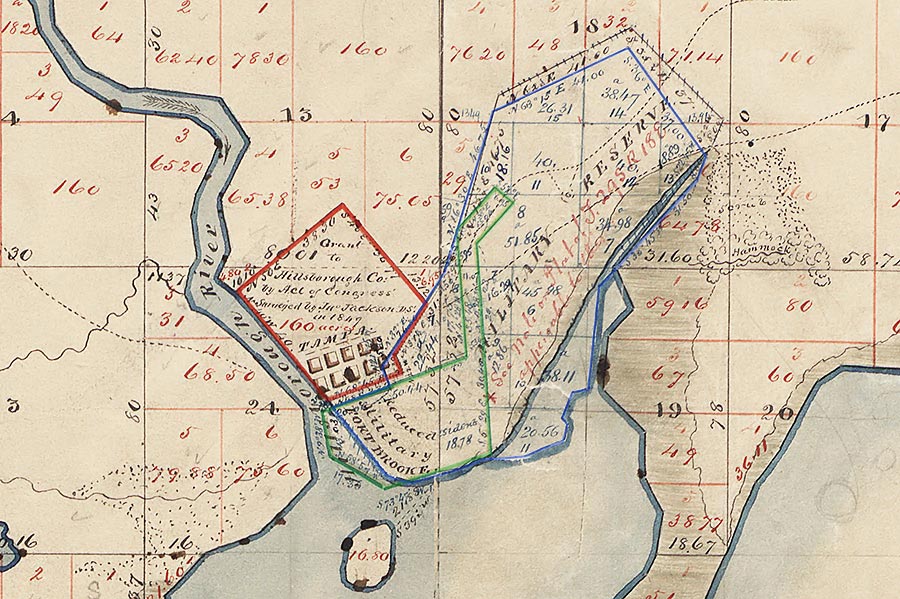
FORT BROOKE RESERVATION REDUCED
On January 21, 1845, Colonel William Worth reduced the military
reservation to four miles square and, after approval by President James
Polk, Hillsborough County obtained 160 acres to the north of the reduced
military reservation. Although Fort Brooke was not to be abandoned for 30
years, it would steadily decline in use by the military from that time.
The county commissioners hired surveyor John Jackson to plat and expand
Judge Steele’s village plan.
Below is a crop of the county
survey of Township 29 south, Ranges 18 east and 19 east showing the
entire area of the military reserve by surveyor Charles F. Hopkins
in March, 1852. Outlined in blue are the original limits of
the military reserve. The ladle-shaped area outlined in green
shows the reduced Ft. Brooke reservation.
The red
outline shows the 160 acres obtained by Hillsborough County
for the county seat.
 |
|
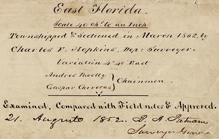 |
Reduced Fort Brooke is
outlined in green, resembling a ladle, the "handle" portion
of which was the property on which the road to the
government spring in today's Ybor City was located.
The dotted line shows the road going on to Fort Dade. |

Read about
life at Ft. Brooke in 1846 - 1846 in an autobiography by
George Ballantine who spent about a year there; published by
Stringer (!) & Townsend of NY, 1853.
Autobiography of
an English Soldier in the United States Army
CHAPTER IX
Ballantine presents a vivid
description of the flora and fauna of the area, as well as
the appearance and behavior of the Seminoles, and how they
passed the time there.
Tampa Bay—Indian
Paradise—Beautiful Squaws—Forest Life—The Hummocks—Snakes—Rumours
of War—Lost in the Wood.
|
|
TAMPA SURVEYED AND
PLATTED
John Jackson's first major job as a surveyor in the new area
was to lay out the town of Tampa in the newly obtained 160
acre tract. The town had been partially platted by Judge
Augustus Steele in 1838, however it appears that this work
was not actually completed except for Tampa and Water
Streets. Jackson was given the job of completing the survey
and extending it into the new areas of settlement. In the
process, he named many of the early streets of Tampa, mostly
after presidents and military leaders.
The Board of County
Commissioners ordered the survey of John Jackson received
and the plan to be recorded immediately. The survey took
just a little over two months to complete and the town plat
was recorded officially on January 9, 1847. The
section surveyed was called the Village of Tampa and
consisted of only the outlines of the town and a portion of
the blocks subdivided. One hundred dollars was paid for this
survey.
John Jackson - Surveyor, Merchant,
Short-term Mayor
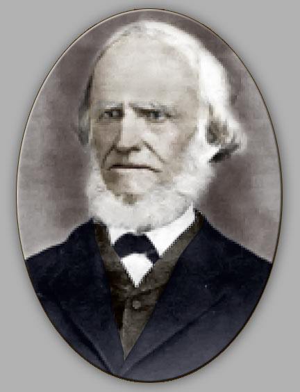 Born
in County Monaghan, Ireland, Jackson immigrated with his
brother Thomas to the United States in 1841. The brothers
traveled to New Orleans where John worked as an Assistant
City Engineer for two years. Born
in County Monaghan, Ireland, Jackson immigrated with his
brother Thomas to the United States in 1841. The brothers
traveled to New Orleans where John worked as an Assistant
City Engineer for two years.
In 1843, the
federal government hired Jackson to survey a large land
grant in present-day Palmetto, Florida. After completing the
assignment, the federal government gave Jackson a permanent
position as a federal surveyor. He accepted this appointment
and then moved to Hillsborough County with his brother
Thomas to begin work. In addition to his salary, the federal
government gave Jackson a large land grant in Hillsborough
County.
Jackson's
work also took him to various regions of Florida and it was
on an assignment in St. Augustine that he met and married
Ellen Maher on July 22, 1847 with whom he had four children:
Thomas, James, Kate and John. Several weeks later,
Hillsborough County hired Jackson to survey and map Tampa
which had been designated the county seat in 1846. Jackson
named the streets of Tampa after U.S. Presidents, military
figures and one local individual, William Ashley, the first
city clerk of Tampa.
[See "What's
in a Name" feature at TampaPix.]
After
completing his assignment, Jackson returned to surveying,
but in 1849 he and his wife decided to move to Tampa where
he established a general store on the corner of Washington
and Tampa Streets. Jackson also became involved in Tampa's
civic activities.
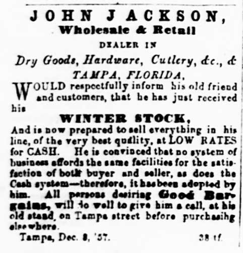
Jackson's ad shows he didn't sell on credit. "He is
convinced that no system of business affords the same
facilities for the satisfaction of both buyer and seller, as
does the cash system."
Elected 9th
Mayor of Tampa on February 3, 1862, Jackson has the dubious
distinction of serving the shortest term as an elected mayor
in Tampa history: 19 days. On February 22, 1862, the
Confederate Military Commander dismissed the mayor, city
council and other employees.
City of Tampa, Previous Mayors
|
FIRST AUTHORIZED
SALE OF LOTS IN TAMPA
When permission had been given to Hillsborough County
officials to erect a courthouse on land formerly occupied by the
troops, a meeting of the board of county commissioners was called
on January 11, 1847 for the purpose of receiving proposals for the
building of a courthouse. "The proposal of James McKay to build
and finish a two-story house 20 by 45 feet in the clear according
to specifications named in his proposals for the sum of $1368 was
accepted by the board." (Notice on the original plat below, the
planned location was 2 blocks east of where it actually was built.
Monroe St. became Fla. Ave. in the mid 1880s.)
Also at this meeting, in order to raise funds to pay McKay,
it was ordered that a sale of lots in Tampa should be made
on the first Monday of next April and that public notice be
given in the Jacksonville News and the Southern Journal,
published in Tallahassee.
Accordingly, the sale of lots with prices
ranging from $25 to $83 a lot was held on April 5, 1847. This sale
would represent the first legal transaction from government to private
ownership of the Fort Brooke land.
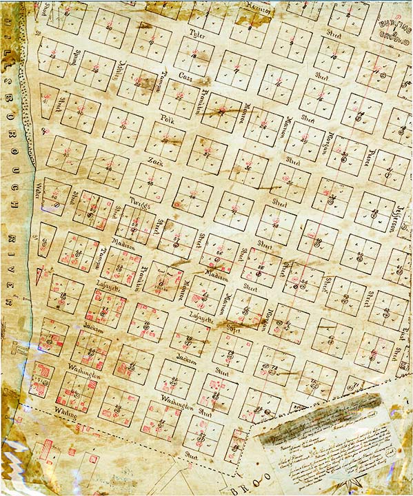
Plan of the Village of Tampa
Surveyed by John Jackson
Recorded Jan. 9, 1847
It is
important to remember that this was a PLAN and not a map of what the area
looked like at the time. It was up to the city to create these
streets according to this plan. One deviation that can be seen is
that originally, the county courthouse was planned two blocks east of
where it was soon built.
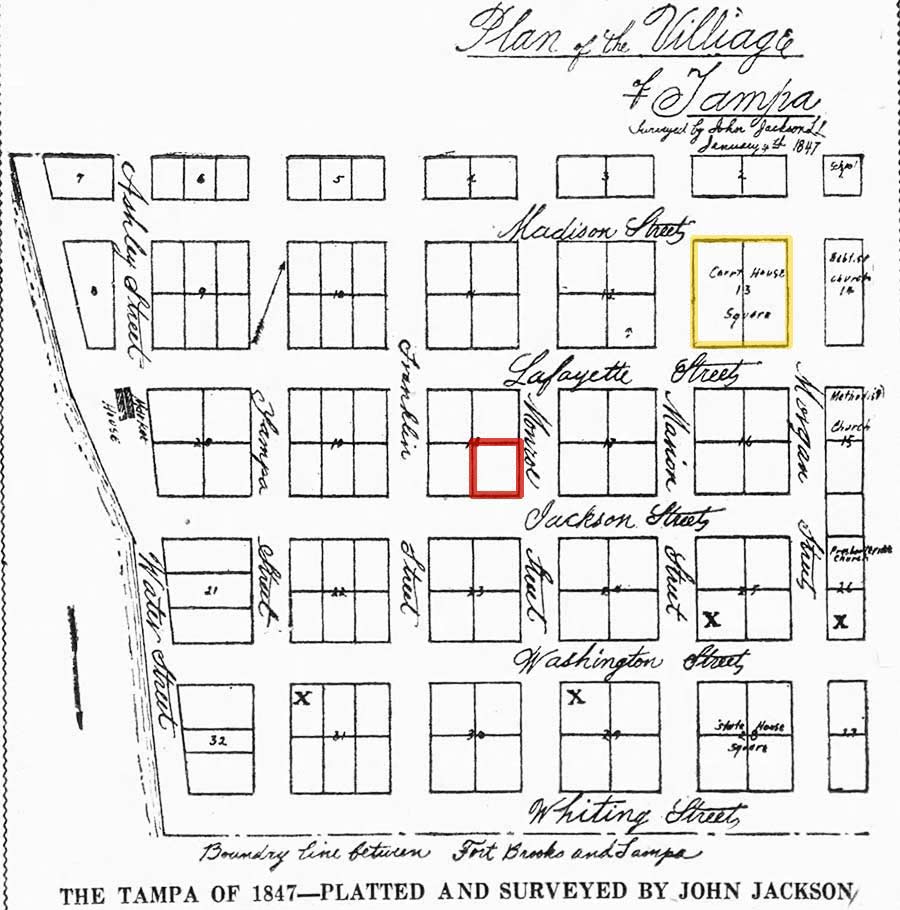
As can be seen above, the
survey
recorded on Jan. 9, 1847, there were no properties marked with owners,
although the large X's might indicate a structure existed there. It
wasn't until April 5, 1847 that lots were sold to the public, so these
details were added later on the 1847 survey. Possibly as each lot
sold, the ownership was added.
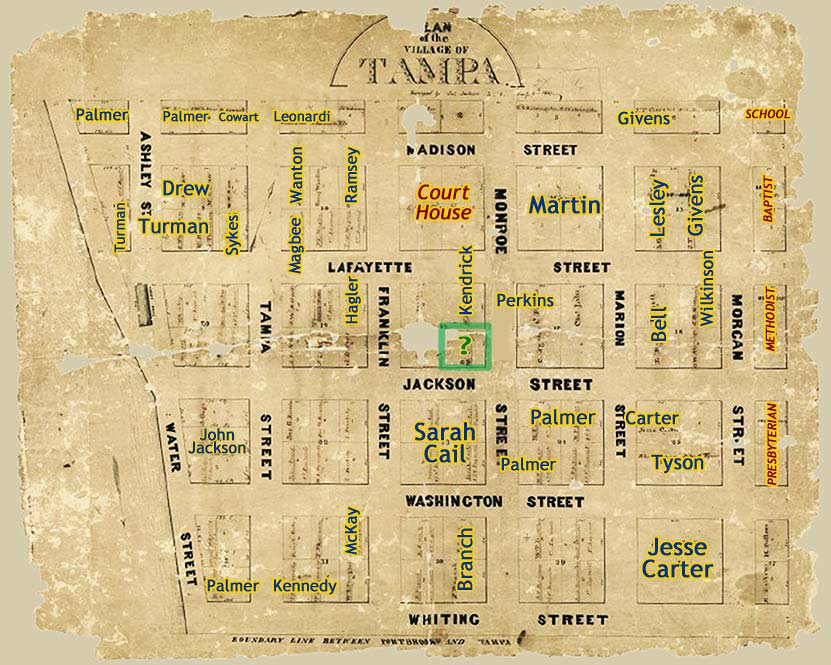
The property owners
have been added here according to what was handwritten in the lots.
This was a very low resolution image and extremely difficult to make out
the owner names. It is possible that there is some error here.

These are close ups of the Stringer property location from two different
online images of the same 1847 survey.
They have been rotated right by 90 degrees so the writing is properly
oriented.
Image from
Judge Steele Left His Mark by Rodney Kite-Powell, Jun. 30,
2013, Tampa Bay Times online.
|
Above, more of the 1853
survey. At right, a close up of the area around the
courthouse. |
In Feb. 1853, John Jackson
drew another survey based on earlier surveys. Here, he
expanded the survey northward and eastward. At some
point, somebody sketched in existing buildings in red.
1853 plan of Tampa
certified by surveyor John Jackson
From the University of South Florida digital map
collection
 |
|
"I hereby certify this map is the original
general map or plat of the Town of Tampa made
and drawn by me in February 1853 from
surveys made by me in the years 1847 - 1850 and
in January 1853. Witness my hand and private
seal. (Signed) John Jackson.
|
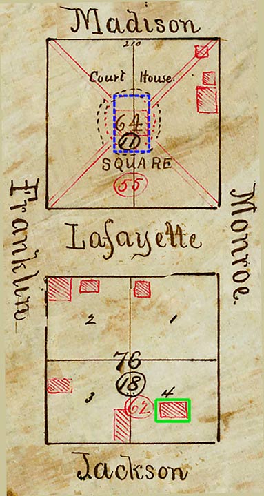 |
The two-block section of the 1853 survey
containing the courthouse and Stringer property
are shown at left. You can see the blocks
have been numbered three times. Originally
block 11 on the 1847 survey it became block 64
on this survey. Another number can be seen
in the same red ink as the structures (55),
possibly cross references to another survey
somehow related to the structures.
At the top edge of the courthouse block can be
seen that the block was 210 feet wide. The
courthouse, the red rectangle in the center, if
drawn to even an approximate scale, would
indicate that this structure was around 40 to 50
feet long. This is very good evidence that
this was the McKay courthouse, which was 20 feet
wide by 45 feet long.
The blue dotted line was added for illustration
here and represents the scaled size of the
courthouse that replaced the McKay courthouse.
That was the "Breaker courthouse" and was 76
feet long and 45 feet wide. The entrance
faced Lafayette St.
It can be concluded that the red structures were
added before the time the McKay Courthouse was
replaced by the John Breaker courthouse in June
1854.
The Stringer property, which was originally
block 18, is now block 76. If this
structure was drawn approximately to scale, it
would appear that the house was a little smaller
than the McKay Courthouse. Possibly 25 x
35 or 40. |
| |
|
|
|
|
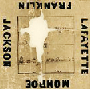
WHAT DOES THIS MEAN FOR THE HISTORIC STRINGER HOUSE?
A plan of the Village of
Tampa by John Jackson was completed in Dec. 1846 and
recorded in Jan. 1847, and the first properties for public
purchase went on sale in April 1847 for the purpose of
financing a courthouse. That plan surveyed a small
area for "The Village of Tampa" from Madison St. southward,
and from the river eastward to Morgan St. and showed the
blocks numbered and partitioned into lots.
In the months or years after the
lots went on sale in April 1847, property owner names were added to
the lots. Given the image of that plan, it is currently not
possible to make out what is written in the lot on the southeast
quadrant of the block where the Stringer house was built. It
appears that not much was written there and it could be that there
was no owner at the time. The northeast quadrant at Monroe (which
became Fla. Ave around 1885) and Lafayette St. shows it was owned by
H. D. Kendrick.
In 1853 Jackson expanded the 1847
plan northward to just beyond Harrison St. and the "Burying Ground"
that would become Oaklawn Cemetery, and eastward to around East.
Street. At some point afterward, structures were crudely
drawn in red ink. It shows a structure of size that could be
the Stringer house at the northwest corner of Jackson and Monroe and
a very small one on the southwest corner of Monroe and Lafayette,
the property indicated on the 1847 survey as being owned by
Kendrick. The structure is too small to be a house.
|
|
|
WERE THE STRINGERS IN TAMPA BEFORE THE
SEPT. 1848 HURRICANE? |
|
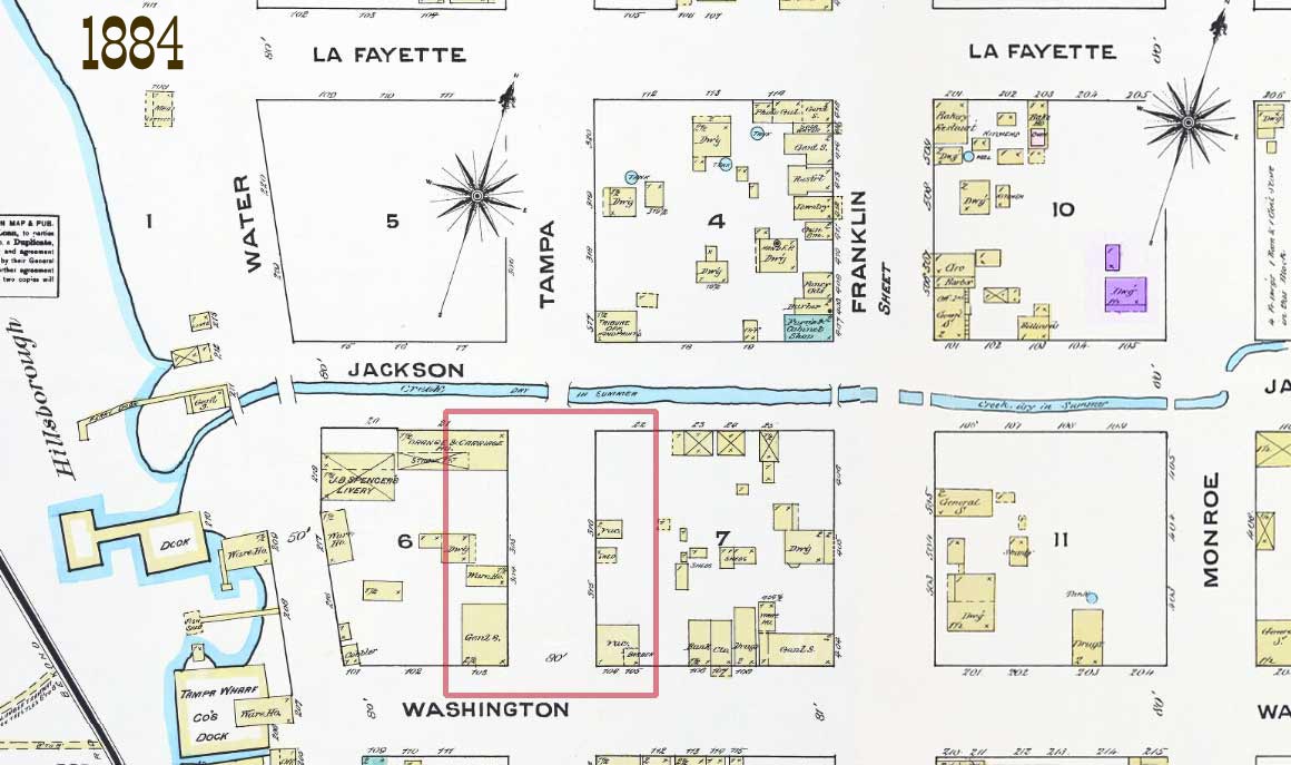
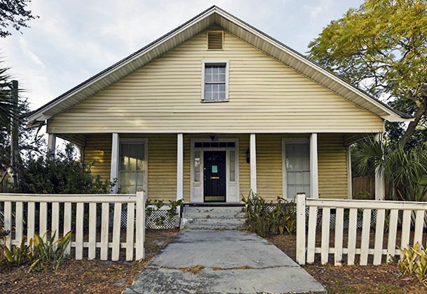
This 1884 Sanborn map
shows the area on Tampa Street between Jackson and Washington
where John Jackson's home was located in 1848. The dwelling
in purple shows the Stringer house still in existence.
Notice the proximity to the river of the location of the Jackson
home compared to that of the Stringer home. There is no
doubt that this whole area around Tampa St. flooded.
READ ABOUT THE FURY OF THIS
HURRICANE AND THE DAMAGE IT CAUSED -- Decide for yourself |
|
Could
Sheldon Stringer have come to
Tampa with his family in 1841, and did his father build
a house near the northwest corner of Jackson Street and
Florida Avenue in 1842? (THE CITY CLERKS OF TAMPA, a
project of the City of Tampa, Sept. 2017.) |
|
The
160 acres on the north side of Ft. Brooke were not given to Hillsborough County by the federal government until after
the military reservation had been reduced, Jan 21, 1945.
As seen above, Jackson's Village of Tampa survey of late 1846
was approved and recorded Jan. 1847. The survey
completed what Augustus Steele had started; that was a plan
along the river consisting of Water St. and Tampa St., just
north of the Ft. Brooke reservation (the boundary being
Whiting St.).
Jackson's survey was a plan,
not a map of what was there. There was no corner of Jackson
Street and Florida Ave. in 1842. (nor Monroe, the
original name of what became Fla. Ave.) Dwellings up
until this time were mostly within the confines of the Ft. Brooke
reservation, and before this, the lands sold by Steele were
invalidated when the Hackley land grant was invalidated 1838.
The Jan. 1847 Jackson survey
below is from E. L. Robinson's History of Hillsborough
Co., published in 1928. It shows blocks from the river
eastward to Morgan St., and from the Ft. Brooke boundary at
Whiting St. northward to Madison St.
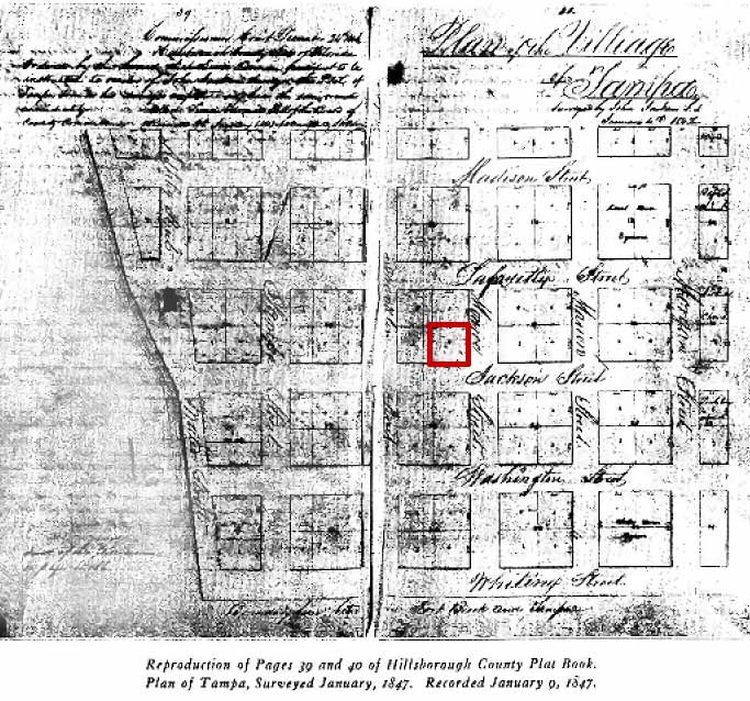
It is a reproduction from the
actual plat book, and so it hasn't been marked with land
owners yet--the land had not yet been offered for sale, but
the lots are indicated. The
first public lots were sold in April of 1847.
In E. L. Robinson's only
mention of the Stringers is in a description of what Tampa was
like just before the hurricane of Sept. 24, 1848:
"A Mrs. Stringer lived on
a part of the present city hall block. it being from her heirs
that the land for the site of the southern portion of the
present city hall was bought in 1914."
See
THE STRINGERS OF FLORIDA, N. CAROLINA,
TEXAS AND WYOMING for evidence that the Stringers probably came to
Tampa between June 20, 1841 and July 1, 1849.
|
|
|
Summary of Fort Brooke years
Various historians who wrote about
the early years of Tampa during the Fort Brooke years say that the
structures in the area were concentrated on the Ft. Brooke property
which was south of Whiting St. There were very few private
citizens who bought land and built a home or business in those times
but they were not authorized by the Federal government since that
land had not been given to the county until 1845 when the size of
Ft. Brooke land was reduced. Florida wasn't even a state until
1845. Those who bought land, private citizens or military personnel,
originally part of the Hackley Spanish land grant before 1838 lost
their claim to the land by around 1840. These historians
mention those early settlers by name and none mention the Stringers.
The most plausible scenario is that
the Stringers came to Tampa when they bought land sometime after the
lot sales which began in April 1847.
|
|