|
|
|
|
Vi·a·duct |
|
Boon·dog·gle noun 1. Work or activity that is wasteful or pointless but gives the appearance of having value. 2. A wasteful or impractical project or activity often involving graft. verb 1. Waste money or time on unnecessary or questionable projects. |
|
The Washington Street viaduct
was the 1909 version of what the Tampa Bay Expressway (tbx) will be.
It was a "bridge to nowhere, used by nobody" and was built at a cost of
$2.6 million in today's dollars on the east end of
Washington Street for the purpose of carrying traffic to the other side of
railroad tracks.
The problem was, there was no reason to go over the other side, as it was the marshland of the Ybor Estuary zone, and so there was no traffic.
|
|
Italic text below is from A History of Tampa, by Karl Grismer, p.225, Edited by D. B. McKay, Published by The St. Petersburg Printing Co., 1950 | |
The most useless structure ever built in Tampa was constructed in
1909 in connection with the Seaboard's development of Seddon Island.
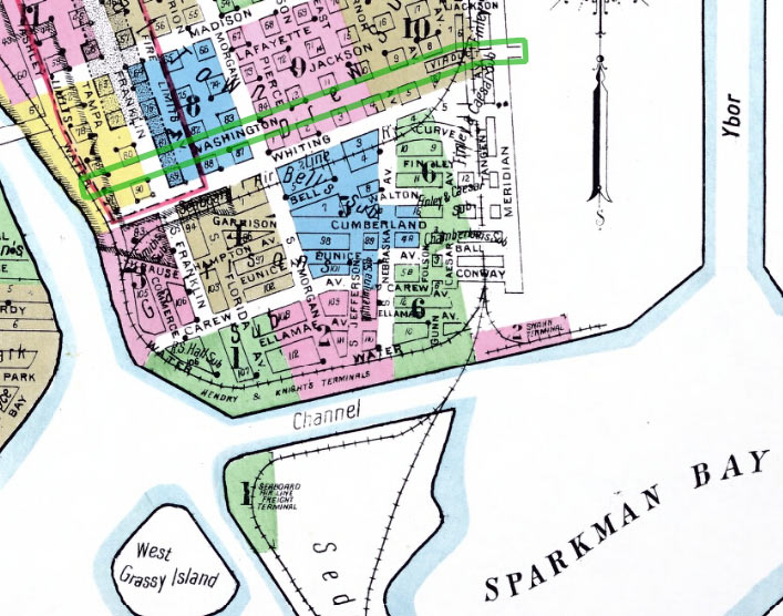
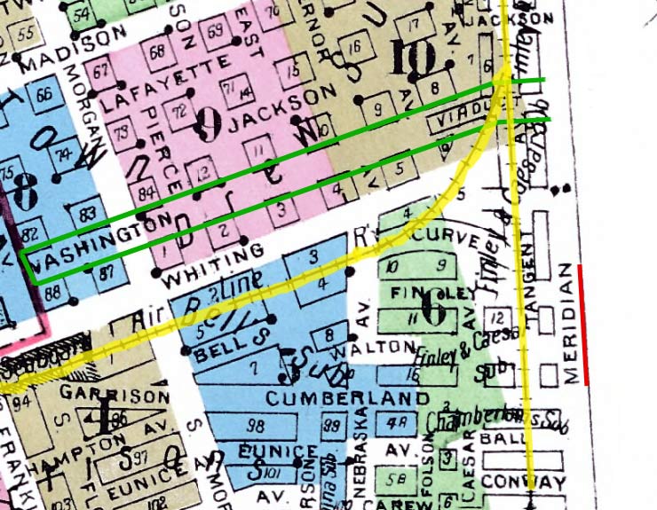
The railroad put down many tracks for a switch yard just east** of Meridian Avenue despite vehement denunciations of nearby property owners who declared that street traffic was being blocked. Washington St. marked in green on 1915 Sanborn map at right. **The tracks were actually just west of Meridian St., not east. |
|
|
|
|
To still the outcry, the Seaboard built a long viaduct over the tracks from the end of Washington Street. East of the viaduct there was nothing but waste marshlands and the structure was never used except by Tampa's early motorists who tested their motors by driving up the steep eastern ramps.
Washington St. marked in green on 1915 Sanborn map at left. |
The structure, which cost at least $100,000, was torn down in the
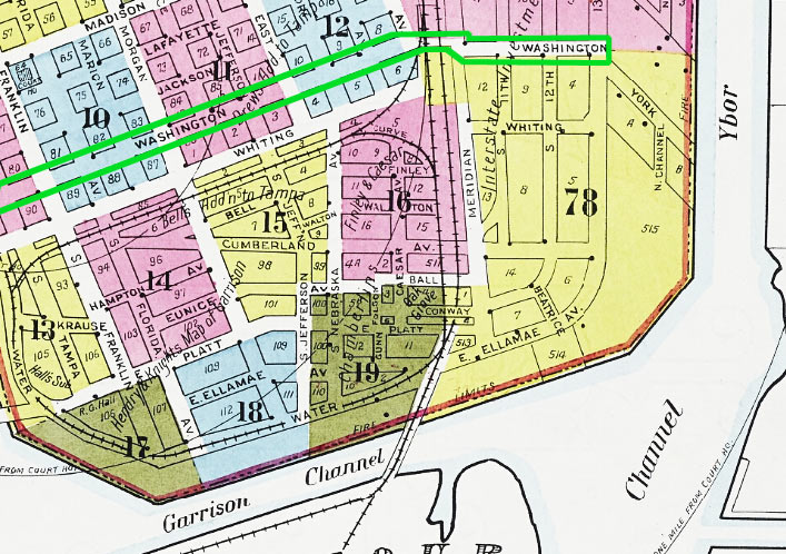
early 1940s and its useless existence finally terminated. Grismer, Karl - A History of Tampa, p.225, Edited by D. B. McKay, Published by The St. Petersburg Printing Co., 1950 The 1931 Sanborn map at right shows some development had taken place east of Meridian Ave. by this time. This whole area was industrial and warehouses until recent development of the Channelside area with condos. Some of the old warehouses were even converted into condos. |
|
1931
Sanborn Map |
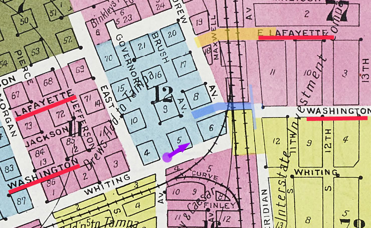
Lafayette St. Viaduct There was another viaduct built over the same tracks and Meridian Avenue along Lafayette Street in 1926. This one was necessary because by this time, Lafayette St. (today's Kennedy Blvd.) had become a main thoroughfare through Tampa to reach Ybor City along 13th Street. This viaduct was in use into the 2000s when the whole area was redeveloped. It was removed and replaced by a standard railroad crossing with gates.
|
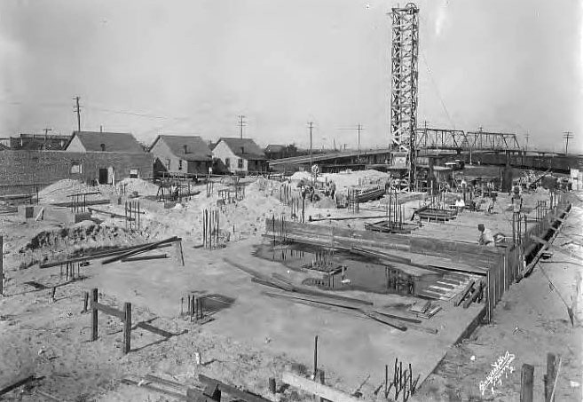
May 16, 1923 Construction of Kingan & Co. packing house at 101 Governor St. looking northwest** toward the Washington St. viaduct. **Governor St. is on the west side of the viaduct. The purple dot on the map above shows the location this photo was taken from, so this a view looking northeast, not northwest as provided in the Burgert photo caption above. Burgert Bros. photo from the Tampa-Hillsborough County Public Library Co-op. |
|
|
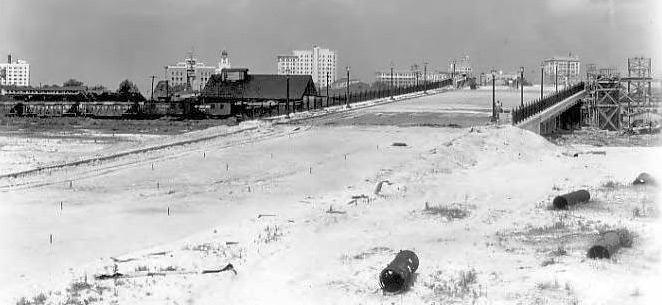
May 29, 1926 Construction on the east end of the Lafayette St. viaduct, looking westward at downtown Tampa. Burgert Bros. photo from the Tampa-Hillsborough County Public Library Co-op.
|
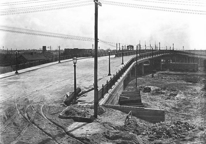
June 19, 1926 Construction progressing on the Lafayette St. viaduct. Looking from the west (downtown Tampa) end northeastward toward Ybor City.
Burgert Bros. photo from the Tampa-Hillsborough County Public Library Co-op. |
|
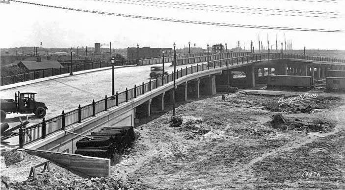
June 19, 1926 Same date and general view of the previous photo. Construction vehicles on the Lafayette St. viaduct. Looking from the west (downtown Tampa) end northeastward toward Ybor City.
Burgert Bros. photo from the Tampa-Hillsborough County Public Library Co-op. |
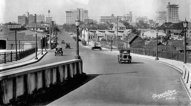
Oct. 21, 1926 A scene of downtown Tampa looking westward from the newly opened Lafayette Street viaduct. Burgert Bros. photo from the Tampa-Hillsborough County Public Library Co-op. |
|
|
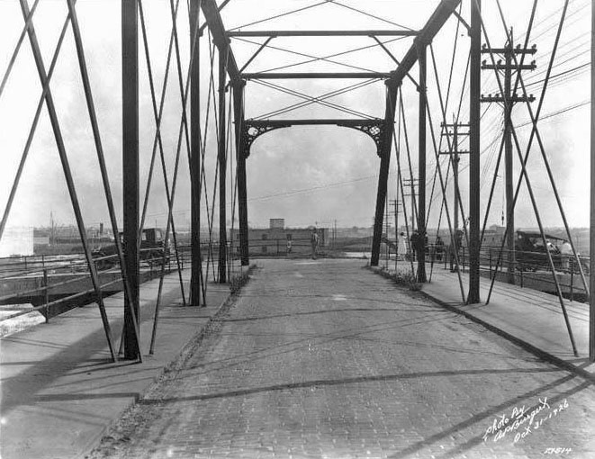
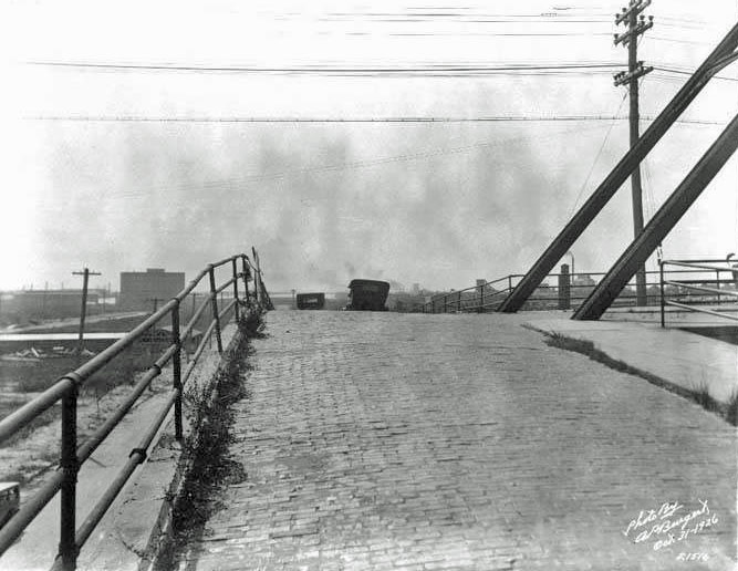
Oct. 31, 1926 Two cars exiting the east end of the Washington St. viaduct and going in opposite directions. Notice that the viaduct ended at a "T" which then continued sloping to street level along Meridian Ave. This was done because beyond Meridian was estuary land in 1909 when the viaduct was constructed; so the ramps came down to Meridian Street in a north and south direction.
|
Oct. 31, 1926 Boys on bicycles at the east end of the Washington St. viaduct, looking north along ramps at Meridian Ave. from just before its highest point, towards the newly built Lafayette St. viaduct. The tank on the right was the Tampa Gas company's propane tank in Ybor City.
|
|
Oct. 31, 1926 Two cars exiting the east end of the Washington St. viaduct and both heading south alongside the ramps at Meridian Ave. Burgert Bros. photo from the Tampa-Hillsborough County Public Library Co-op.
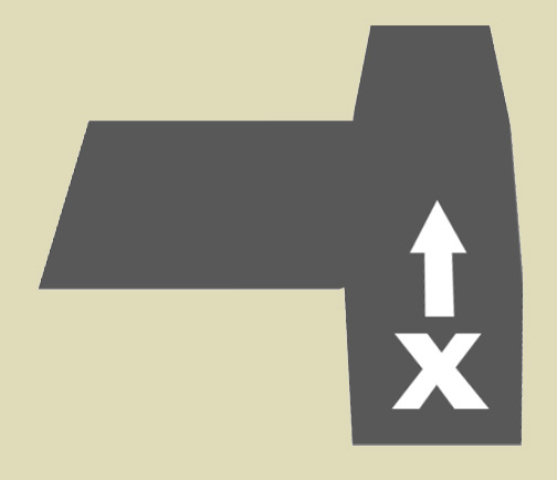
Imagine standing at one end of the crossbar (alongside Meridian Ave.) of a "T" looking towards the other end (southward), which slopes downward so you can only see to the intersection, and the upright of the "T" is to your right (viaduct). |
|
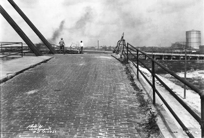
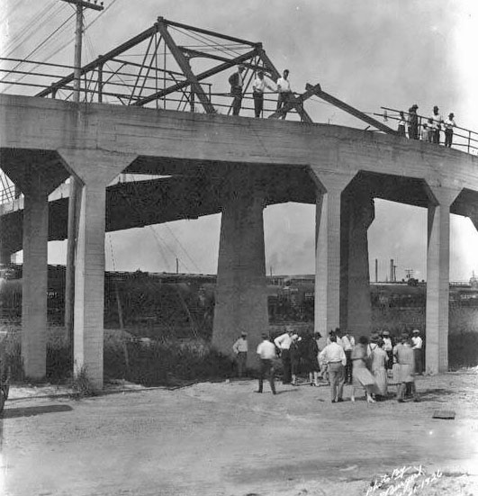
Oct. 31, 1926 Spectators at an accident scene at the Washington St. viaduct look down from the makeshift repairs of the viaduct ramps guardrail toward spectators gathered below on Meridian Ave. At the top can be seen the support framework for the viaduct which connects to the ramps at a "T" alongside Meridian Ave. which runs to the left and right of the photo. Burgert Bros. photo from the Tampa- Hillsborough County Public Library Co-op. Apparently, all the Oct. 31, 1926 photos were of this accident scene. |
|
|
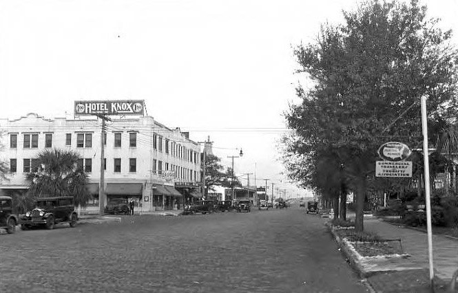
Jan 11, 1934 Looking east along Lafayette St. from Tampa towards the Lafayette St. viaduct in the distance. Burgert Bros. photo from the Tampa-Hillsborough County Public Library Co-op.
|
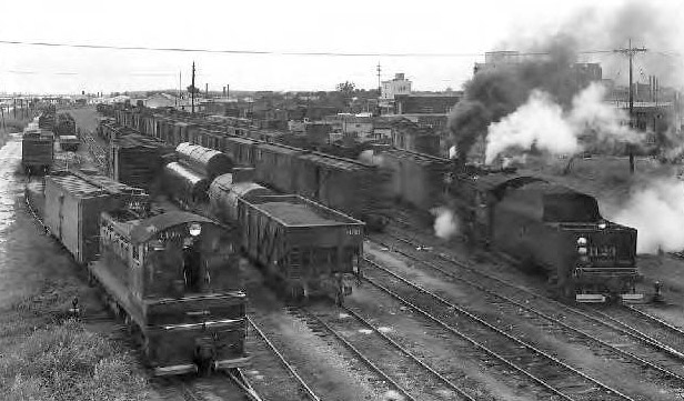
July 27, 1948 Locomotives and freight cars in Seaboard Air Line Railroad yard south of Lafayette St. viaduct in the Estuary Zone. Burgert Bros. photo from the Tampa- Hillsborough County Public Library Co-op.
|
|
|
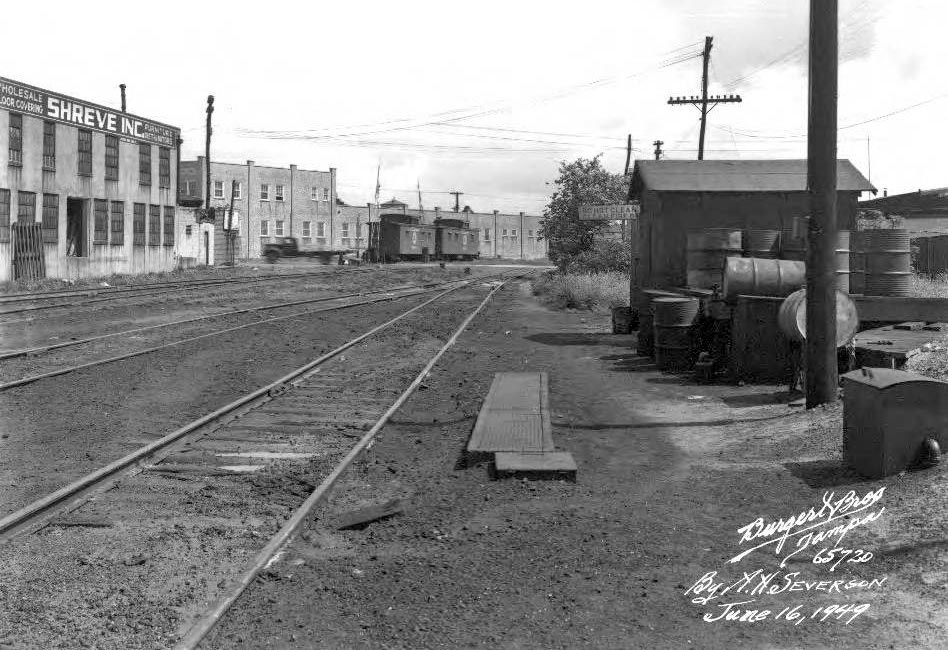
June 16,
1949 - Looking north from below the Lafayette St. viaduct at Seaboard Air
Line Railroad tracks between Lafayette Street and Twiggs Street, with
Shreve Incorporated wholesale furniture warehouse in background. |
|
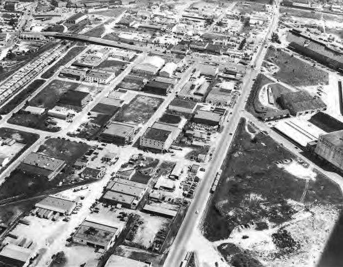
1954 Estuary zone looking north at Thirteenth Street with Lafayette Street Viaduct.jpg Burgert Bros. photo from the Tampa-Hillsborough County Public Library Co-op.
|
|
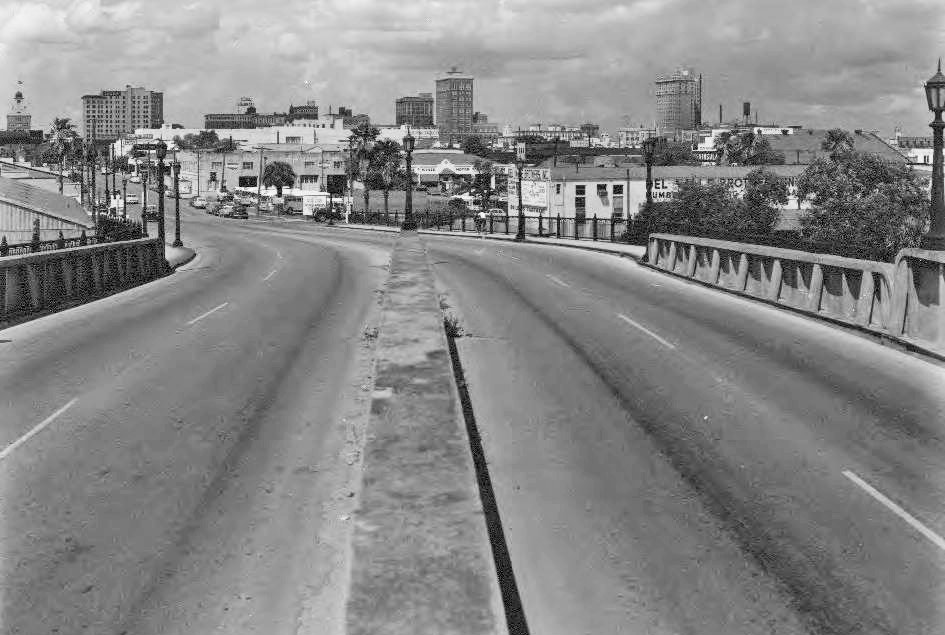
1954 -
Looking west from the Lafayette St. viaduct towards downtown Tampa |
|
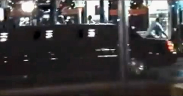
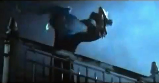
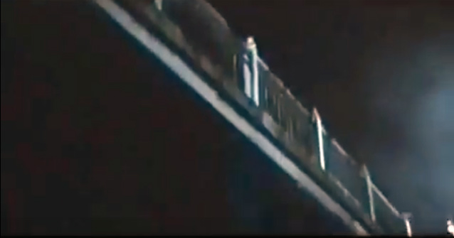
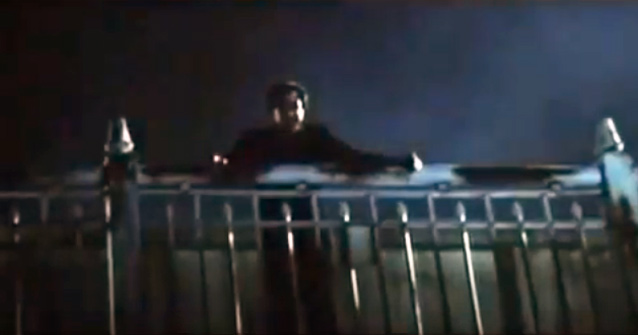
In this scene of the 2004
movie "The Punisher" filmed in Tampa, John Travolta as "Howard Saint"
drives his wife to the Kennedy Blvd. viaduct and tosses her over the side
onto the tracks of an oncoming train. The start of the scene shows Saint's limo passing in front of the Columbia Restaurant on 7th Avenue (going the wrong direction if he's heading to the viaduct.) Later in the movie, when Saint's son asks "Where's mom?" Saint replies, "She took a train." |
|
|
|
|
|
|
|
|
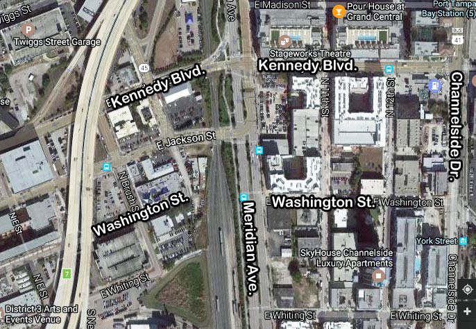
Today,
the Kennedy Blvd. (f.k.a. Lafayette St.) viaduct is gone and replaced with
a standard railroad crossing. It serves as Hwy. 60 through downtown
and is one-way westward.
The only other street to
cross the tracks along Meridian Ave. is Jackson Street, which also serves
as Hwy. 60 one-way eastbound through downtown. 13th St. is now Channelside Drive.
Meridian Ave. has gone from being a two-lane road to a 6-lane thoroughfare with left turn lanes and landscaped medians.
|